
In today’s data-driven world, businesses rely heavily on visualization tools to make sense of complex information. One such tool that has revolutionized the way we analyze data is Excel. But did you know that Excel can do more than just crunch numbers and create charts? With the integration of Mapcite’s geospatial data mapping capability, Excel becomes a powerful tool for unlocking valuable insights and unleashing the potential of location-based data.
In this article, we’ll explore the advantages of harnessing Mapcite’s geospatial data mapping within Excel which is all available with the free Mapcite Excel add-in from the Microsoft App Store at:
Visualizing Data in Context:
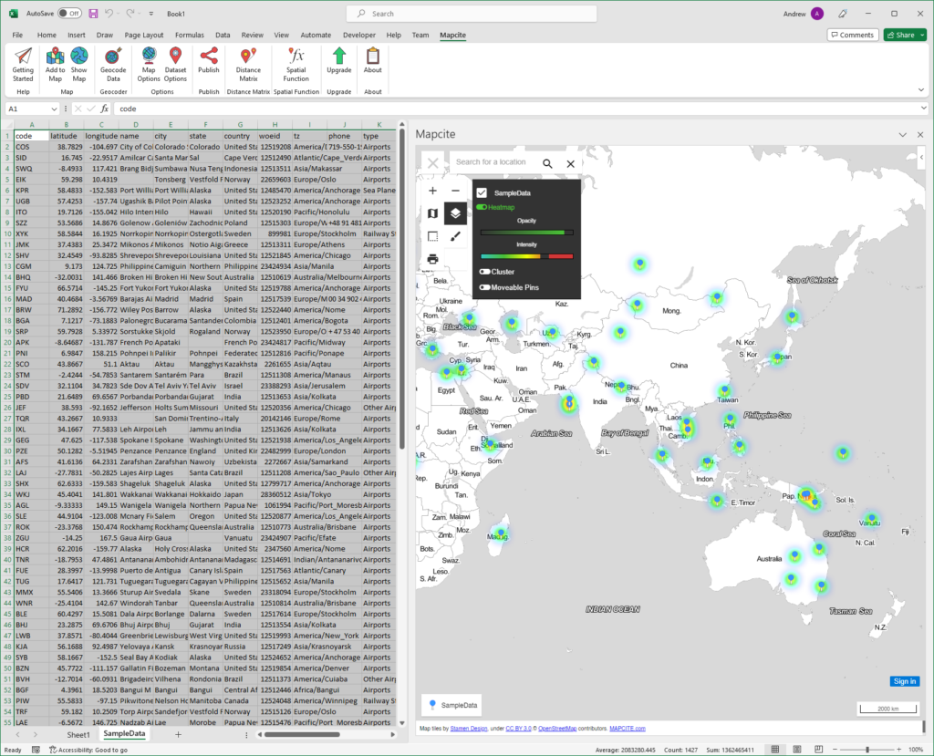
Geospatial data mapping enables you to overlay your data onto maps, providing a visual representation of information in its geographic context. Instead of looking at rows and columns of numbers, you can instantly see patterns, trends, and relationships based on location. Whether you’re analyzing customer demographics, sales territories, or the spread of a disease, geospatial mapping in Excel offers a clear and intuitive way to grasp complex spatial data.
Enhanced Decision-Making:
By integrating geospatial data mapping into Excel, you gain a powerful tool for making informed decisions. The visual representation of data allows for better understanding and identification of geographic trends and patterns. You can identify hotspots, clusters, and outliers, helping you identify areas of opportunity or areas that require further investigation. This enhanced decision-making capability empowers businesses to optimize their strategies, allocate resources efficiently, and uncover new market insights.
Seamless Data Integration:
One of the key advantages of leveraging geospatial data mapping within Excel is the seamless integration of different data sources. Excel provides a familiar environment where you can easily import and combine data from various formats, such as spreadsheets, databases, and online sources. By integrating geospatial data alongside your existing data sets, you can explore correlations between location and other variables, unlocking hidden relationships and uncovering new insights. The capability of Mapcite to layer multiple data sets allows much greater insight.
Customizable Visualization:
The Mapcite Excel add-in’s geospatial data mapping capabilities offer flexibility in visualizing data according to your specific needs. You can customize the appearance of maps by choosing from different map styles, colours, and symbols. This allows you to create visualizations that align with your brand or present information in a way that effectively communicates your message. With the ability to add legends, labels, and annotations, you can create compelling and informative maps that tell a story and captivate your audience.
Collaboration and Communication:
Mapcite’s Excel add-in geospatial data mapping features enhance collaboration and communication within teams and stakeholders. With the innovative Publish feature of the Mapcite add-in you can share interactive maps across your organisation via a simple URL link. By presenting data in a visually engaging format, you can facilitate discussions, align strategies, and foster a deeper understanding among team members. Geospatial data mapping in Excel bridges the gap between data analysis and effective communication, making complex information accessible and actionable for all.
Conclusion:
Mapcite’s geospatial data mapping capability within Excel is a game-changer for businesses seeking to gain a competitive edge in today’s data-driven landscape. By visualizing data in its geographic context, making informed decisions becomes easier, seamless data integration becomes possible, and customizable visualizations empower effective communication. With these advantages at your fingertips, you can uncover valuable insights, optimize strategies, and unlock the full potential of your location-based data. So, embrace the power of geospatial data mapping in Excel with the Mapcite add-in, and watch your data-driven decisions take flight.