
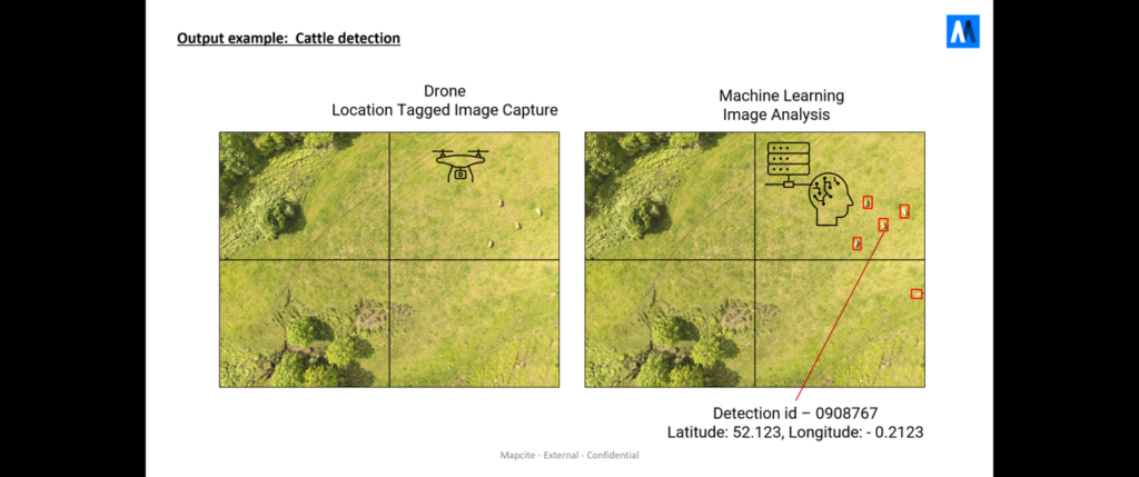
Knowing where your livestock are and identifying potential threats are very important to farmers and cattle ranchers. When the territory is large, this becomes difficult, time consuming and a major cost. The advent of camera mounted drones provides the opportunity to automate this process, reduce the cost and allow it to be done more frequently. However, the drone and camera are only one part of the solution. Detection of the livestock and threats from camera images using AI/Machine Learning and visualisation of the locations are also needed.
How Can Mapcite Help?
Mapcite can provide all elements of the solution:
• Using the commercially available drones, best suited to the specific task. These can include rotary or fixed wing drones, powered by battery or liquid fuel, depending on the range requirements
• Selecting the most appropriate cameras, providing both standard imagery, video and thermal
• Creating trained AI/Machine Learning detection that can process the drone captured images for thermal or standard aerial imagery
• Providing easy to use software tools to visualise the location of the detections